Tag Archives: Trenton

Seeing Old Battlefield Maps in a New Way

Previously, I’ve written about maps and layers in General Staff (here). A General Staff map is made up of background, elevation, terrain, slope, units, AI, water and road layers. Recently, while working with scans of very old battlefield maps, I discovered an amazing effect.
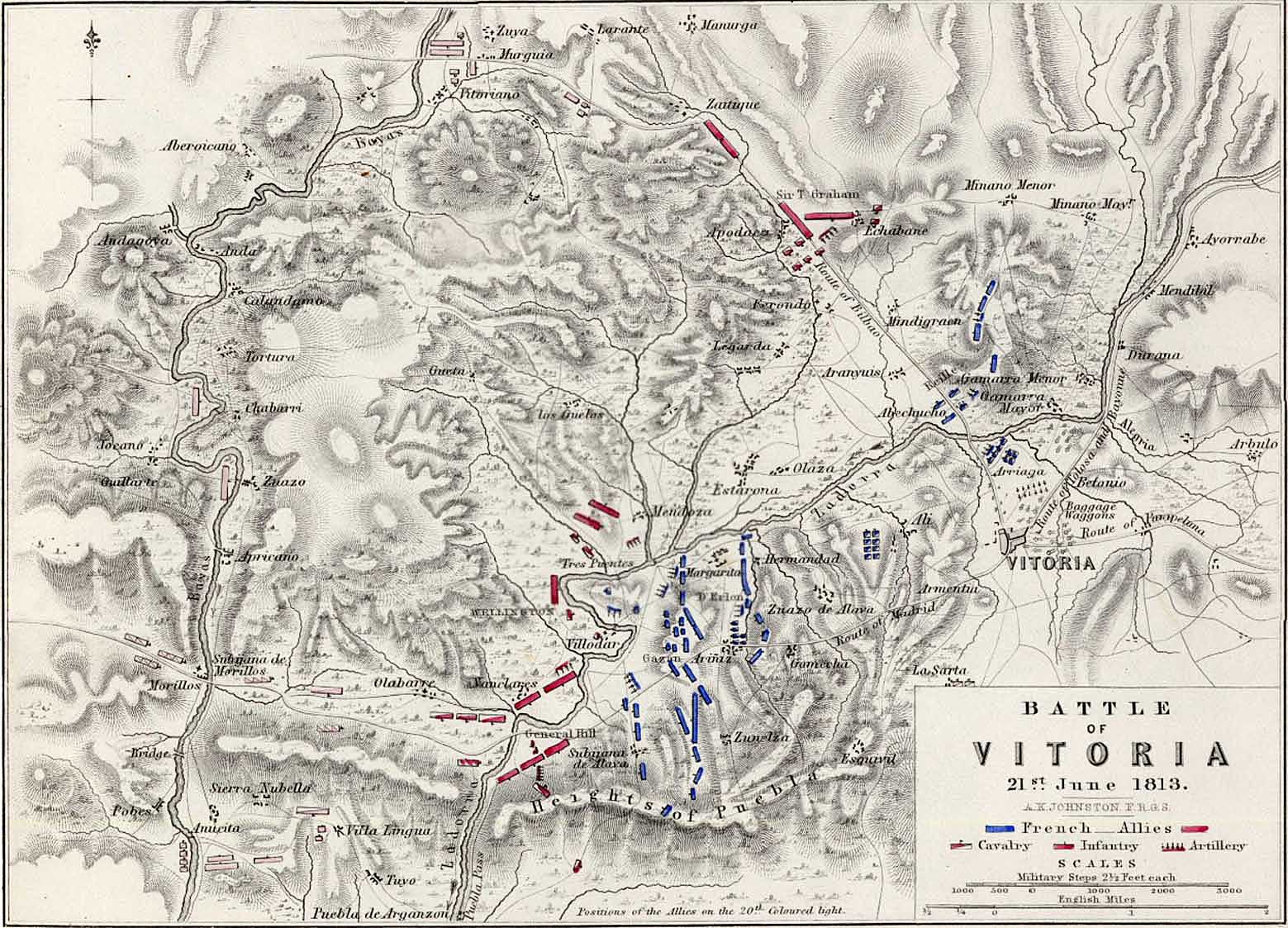
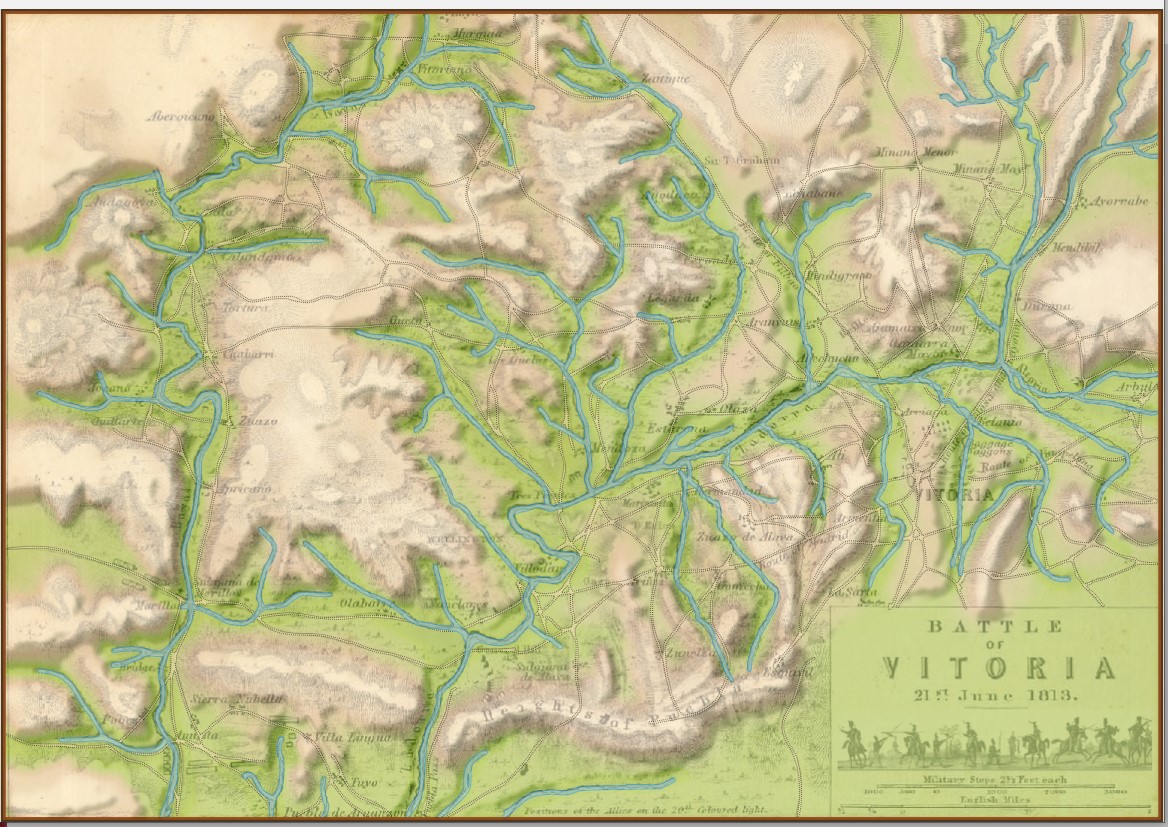
The battle of Vitoria. From, an “Atlas to Alison’s History of Europe: Constructed and Arranged, Under the Direction of Mr. Alison. 12 volume History of Europe (An Attractive And Complete Set Of Books Comprising Alison’s Europe).” The maps are made by W & A K Johnston Ltd, one of the major map publishing houses of the 19th century. William Johnston (1802–1888) and his brother Alexander Keith Johnston (1804–1871) originally trained as engravers, and founded the firm in 1826. The atlas, prepared by A K Johnston, was published by Wm Blackwood & Sons around 1850. Thank you, Mike Oliver for this background information on this map and the atlas that it came from. Click to enlarge.

The above map comes from a wonderful atlas illustrating numerous Napoleonic era battles. These are the kinds of maps that inspired General Staff. As a kid I used to look at similar maps (and, of course, The West Point Atlas of American Wars) and imagine commanding units on the battlefield. The problem with maps like these is that they don’t actually contain any data that computers can use. Humans can look at the above map and see hills, valleys, towns and rivers. But, to a computer, this is just another image. The process of converting this map into computer usable data involves the General Staff Map Editor.

Ed Kuhrt, my old friend, superb musician, talented jeweler (he made my wife’s heart-shaped diamond ring), and excellent artist made this height map from the original map (above) using PhotoShop; though he could have used the General Staff Map Editor and a digitizing tablet as well.
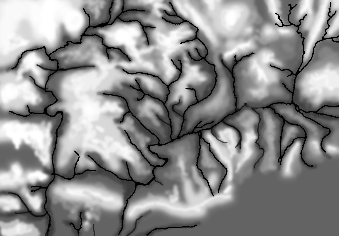
Height – or elevation – map produced by Ed Kuhrt from the Vitoria battlefield map. Click to enlarge.
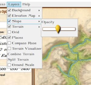
A slider and checkbox for adjusting the visibility (transparency) of the Slope Layer in the Map Editor.

Prior to this Andy O’Neill had just implemented precalculating slopes. In my original work with least weighted paths and slopes I calculated slope ‘on the fly’. Andy, quite correctly, realized that these values could be calculated in advance and stored as part of the map data. This, of course, would save time when calculating optimal paths for units (and also calculating combat equations which involve slope). Consequently, Andy added another visual layer – a slope layer – to visualize the slopes (see right).

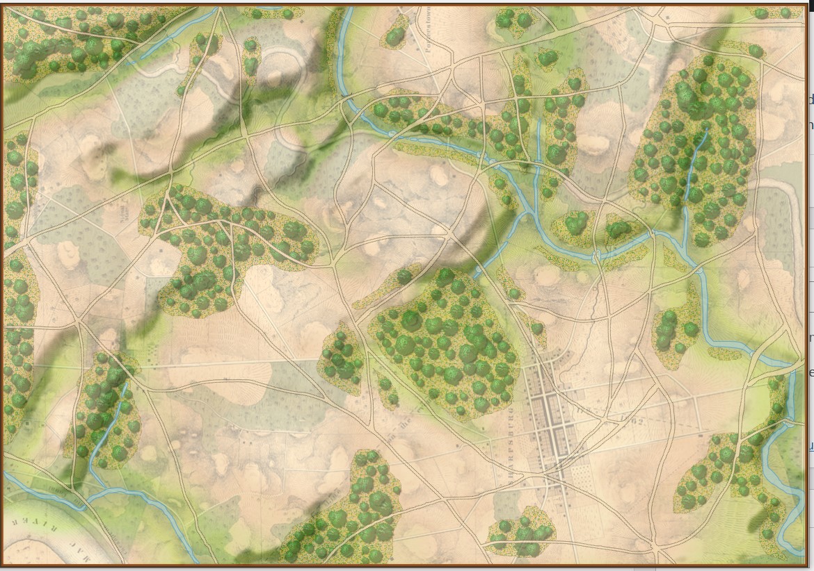
It was while working in the Map Editor with the Vitoria battle map, and adjusting the sliders for the various layers that I discovered this amazing effect:This map (above) certainly reminds me the plastic 3D maps we used to see back in grade school. I think they look fantastic. Here are some more:
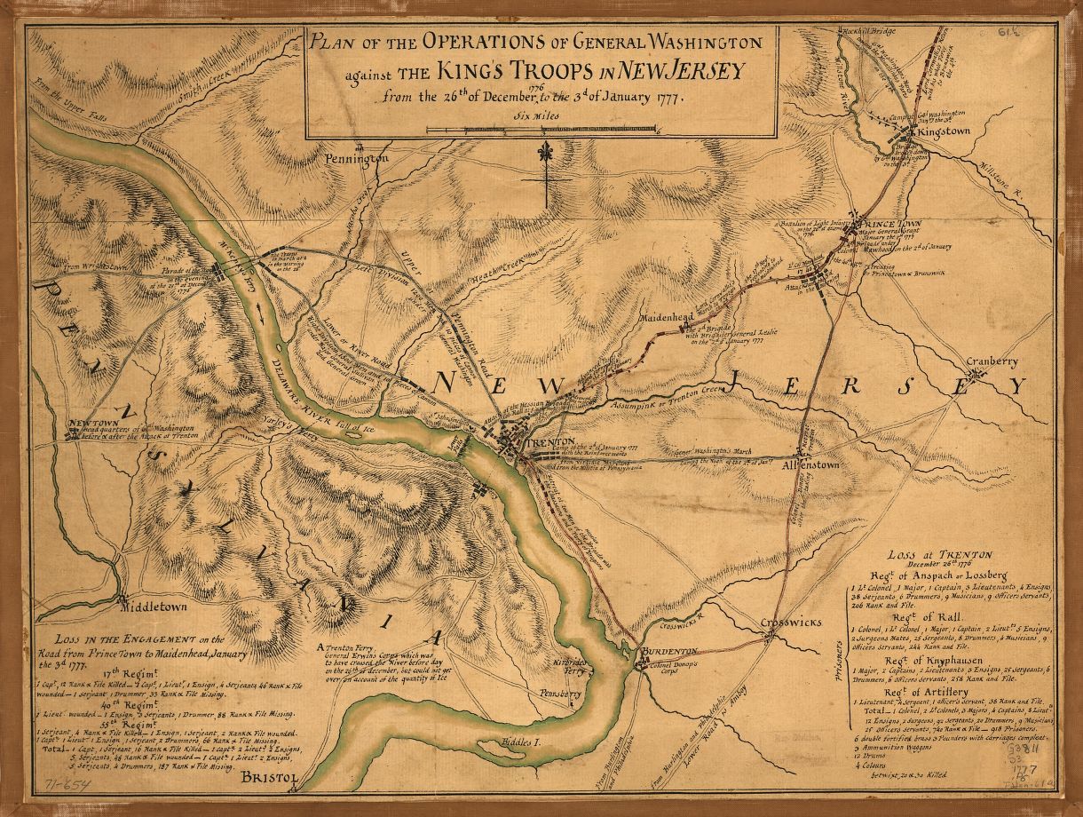
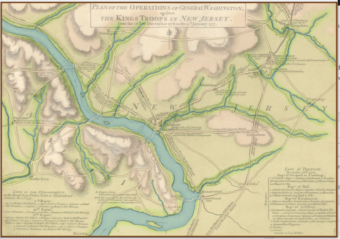
This map is from the US Library of Congress and can be downloaded here.

Trenton map with slope and elevation increased. Click to enlarge.

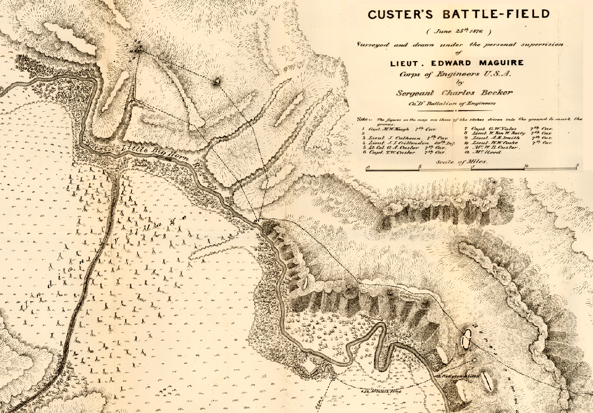
Fantastic map of the Little Bighorn battlefield done shortly after the battle. Click to enlarge.

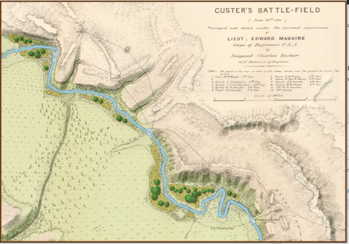
Little Bighorn battlefield with slope and elevation emphasized. Click to enlarge.

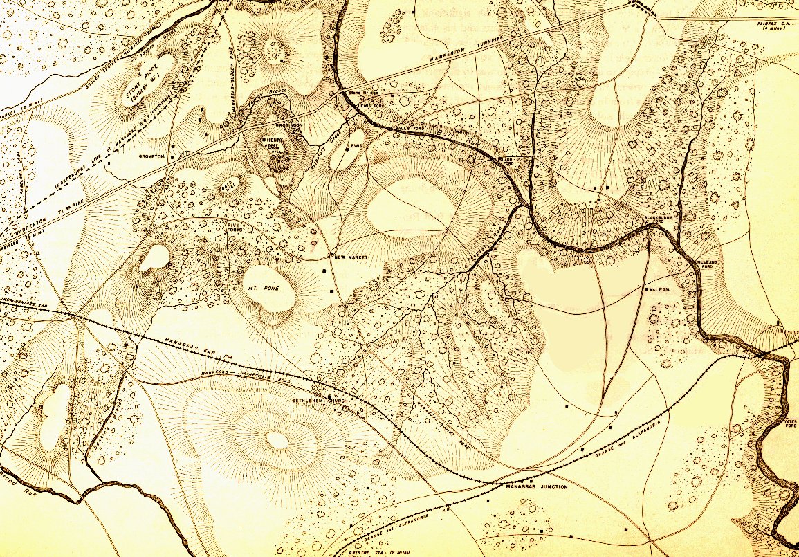
Battlefield of 1st Bull Run from the West Point Atlas of American Wars Volume 1. Click to enlarge.

1st Bull Run battlefield with slopes and elevation emphasized. Click to enlarge.

I Was Wrong About George Washington

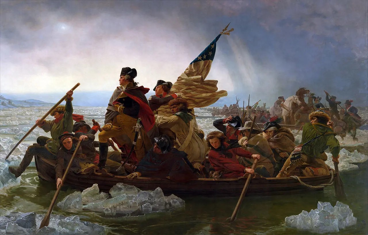
Washington Crossing the Delaware by Emmanuel Luetze. 1851. The Metropolitan Museum of Art. Click to enlarge.

I must confess that I was never much a fan of George Washington’s generalship. Having not studied American Revolution military history I thought that from 1776-1781 the British chased Washington and his sad excuse for an army up and down the eastern seaboard of what was to become the United States until the French Comte de Grasse defeated the British naval forces at the Battle of the Chesapeake and the Comte de Rochambeau at the head of a French army surrounded, besieged and eventually captured, Cornwallis at Yorktown.

To make matters worse, years ago I stumbled upon George Washington’s Expense Account which is, frankly, brutal. Washington turned down the magnanimous salary of $500 a month for being Commander in Chief of the Continental Army famously saying,

“As to pay, Sir, I beg leave to Assure the Congress that as no pecuniary consideration could have temped me to have accepted this Arduous employment (at the expense of my domesttic [sic] ease and happiness) I do not wish to make any Proffit [sic] from it. I will keep an exact Account of my expences. Those I doubt not they will discharge, and that is all I desire.” 1)George Washington’s Expense Account, Washington, George & Kitman, Marvin, page 15

If Washington had accepted the salary he would have been paid $48,000 for five years’ service. Instead, his ‘expences’ came to $449,261.51! This book – and it contains a photocopy of every page of Washington’s Expense Account in fine copperplate handwriting along with a humorous explanation of the expense – is damning. Washington’s very first entry for June, 1775 was for $6,214 (over an entire year’s salary at $500 per month) for “…the purchase of five Horses… to equip me for my journey to the Army at Cambridge – & for the Service I was Then going upon  – having sent my Chariot and Horses back to Virginia.” There are also numerous expenses for cases of the finest wines and plenty of food while at Valley Forge. Not surprisingly, when Washington offered Congress the same terms when he was elected president (no salary just expenses) Congress insisted that he take $25,000 a year; no expenses paid.

Like most Americans, what little knowledge I had of the battle of Trenton can be summed up in Luetze’s famous painting, above: Washington, posed heroically, crossed the Delaware River on Christmas Eve and surprised a garrison of drunken Hessian mercenaries at Trenton capturing them all without a shot. In reality, not much of that is true. Yes, Washington did attack Trenton but it was on the morning of December 26, 1776, and the Hessians weren’t drunk; they fought bravely and their commander, Col. Johann Gottlieb Rall, died leading them.

Then I discovered (from reading David Hackett Fischer’s Pulitzer Prize-winning Washington’s Crossing) that the amazing part of the story wasn’t the battle of Trenton (which really was an extraordinary tale of a small, poorly-equipped, non-professional army making an audacious amphibious crossing of an ice-choked river) but the campaign that followed the victory from December 30, 1776 to January 3, 1777.

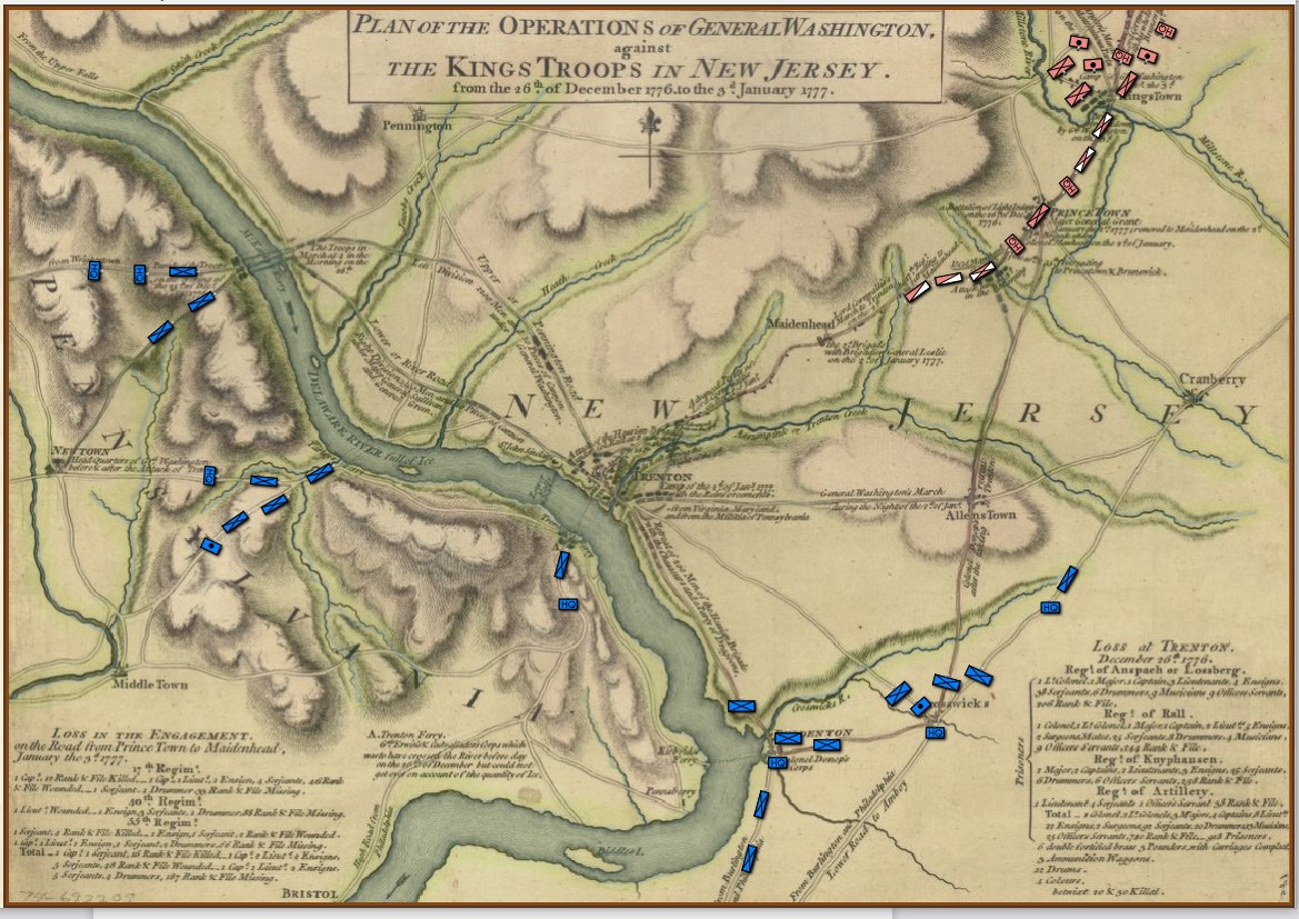
The strategic situation in the Princeton / Trenton area, December 29, 1776. Screen shot from the General Staff Scenario Editor. Click to enlarge.

Washington’s forces had made it safely back across the Delaware River after the Trenton raid but he now faced a difficult decision: terms of enlistment were running out for many units in his army and he feared taking the field again in bitter cold with a diminished force. As always, Washington held a council of war. As the senior commanders of the army advised caution a courier arrived informing them that Brigadier General John Cadwalader with his Pennsylvania militia had already crossed the Delaware and was at Crosswicks itching for a fight with the British (this is the blue force at the bottom of the map, above). After more discussion, one group stated, “tho’ they would not have advised the Movement, yet it being done it ought to be supported.”2)Washington’s Crossing, David Hackett Fischer page 266. Eventually, with Washington’s urging, the council voted to support Cadwalader, recross the Delaware and, again, defeat the British in the field.

This was a bold strategy; a defeat of the Continental Army with its back to a river would probably spell the end of the revolution. Washington’s plan was to assemble his forces east of Trenton, in a strong defensive position on ‘good ground’ behind the Assunpink Creek and lure Cornwallis, who was commanding the British and Hessian forces, to attack. This Cornwallis did and was soundly defeated. Washington now moved decisively, sending his forces to capture Prince Town (Princeton) to the north. At the crucial moment in this battle Washington rallied the routed Pennsylvania forces saying, ” ‘Parade with us, my brave fellows! There is but a handful of the enemy, and we will have them directly.’ Washington [then] led his men straight into the center of the battle, within thirty paces of the British line. He was mounted on a white horse, an easy mark for any British soldier.”3)Ibid. page 334

Frankly, I cannot comprehend such bravery. The attack, of course, was a success and the Americans captured Princeton and, perhaps more importantly, demonstrated that their volunteer army would fight, could fight and could win. Washington showed superb strategic and tactical vision throughout these ten crucial days4)See https://tencrucialdays.org/wp-content/uploads/2019/09/eb14b5212fb62dfea8d100f3efd1950f.pdf  for a wonderful series of maps that cover this campaign as well as extraordinary personal courage.

I was wrong about George. Washington.

References

References
1 George Washington’s Expense Account, Washington, George & Kitman, Marvin, page 15
2 Washington’s Crossing, David Hackett Fischer page 266
3 Ibid. page 334
4 See https://tencrucialdays.org/wp-content/uploads/2019/09/eb14b5212fb62dfea8d100f3efd1950f.pdf  for a wonderful series of maps that cover this campaign