Category Archives: Map Design Module

Results of the Splash (Hachure) Contours vs. Concentric Elevation Contour Survey

The results of our survey to determine if you preferred splash (hachure) contours or concentric lines to represent elevation on General Staff maps are in: 58.21% voted for concentric contour lines and 41.79% voted for splash or hachure contour lines.

The results of our splash (hachure) contour lines versus concentric contour lines survey. 58.21% for concentric contour lines, 41.79% for splash contours.

However, while waiting for the results of the survey we wound up writing a splash (hachure) contour algorithm anyway:

An example of splash contours.

This isn’t perfect and we’ll continue to optimize it. However, General Staff will now include both methods of displaying elevation on a map: splash (hachure) and concentric elevation lines.

Help Us Decide: Splash Contours or Elevation Contours?

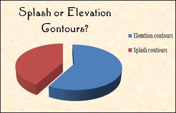
We need your input on how elevation (hills and ridges) will be displayed in General Staff. Originally we had planned on using ‘splash contours’. Splash contours were often used in quick sketch maps on the battlefield and they have an authentic look to them.

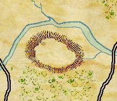
An example of a splash contour representing a hill (artwork by Ed Isenberg).

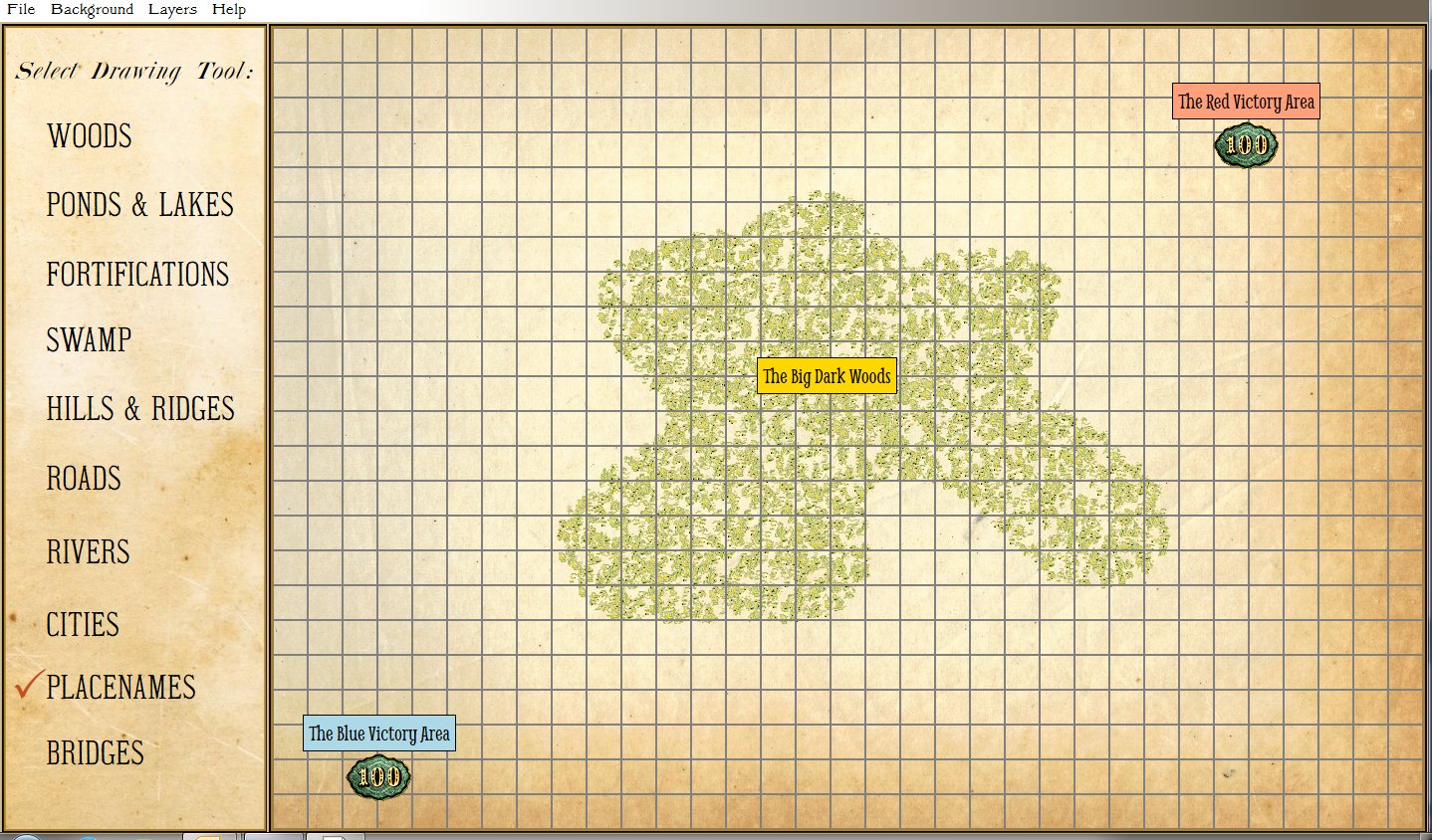
However, recently “Cry Havoc” – a Grognard on Facebook – asked if we were going to include the original Kriegsspiel Meckel map with General Staff. That got us thinking and taking another look at the original Kriegsspiel maps. Below is a map from the original American Kriegsspiel (circa 1892-8):

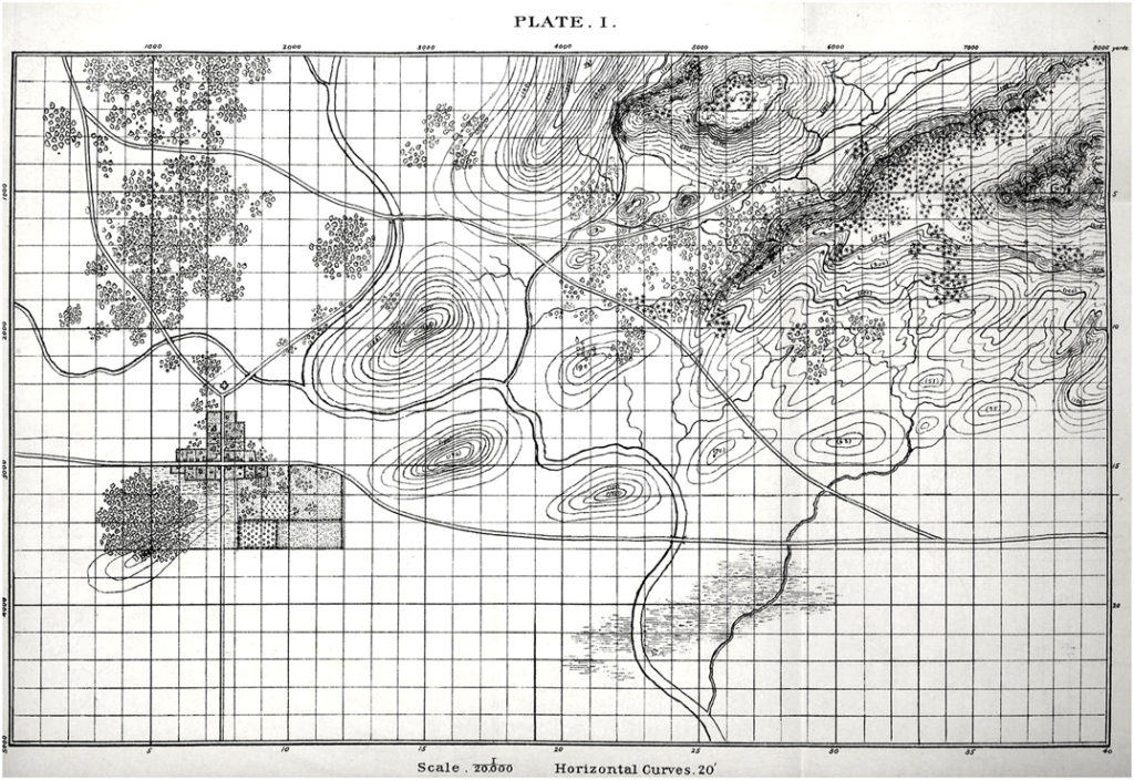
An original American Kriegsspiel map (circa 1892). Note the elevation contour lines. Click to enlarge.

Obviously, concentric elevation contours were in use in the 19th century so we could be authentic using either method of display.

This leads us to a very simple user survey:

[os-widget path=”/drezrasidran/splash-contours-or-concentric-elevation-contours” of=”drezrasidran” comments=”false”]

First Look at the Design Map GUI

This is just a quick screen capture to show what the interface (or Graphical User Interface, or GUI) is for the Design Map Module of General Staff. Simply click on the pallet on the left and draw on the map. You can also select from a number of weathered paper effects for a background.

Screen capture of the General Staff Map Design Module (click to enlarge).

Update on the Map Design Module & a New Algorithm

The work on the Map Design Module is progressing much faster than we dared hope. Along the way we had to invent a new fast scanline fill algorithm. The two images, below, are screen captures that show how easy it is to create new maps for General Staff. To create a new area of forest or woods, simply select the ‘Draw Woods’ tool and make an outline (the program will automatically connect your starting and end points):

Screen capture from General Staff Map Design Module showing the method for creating new woods and forests. Select the tool and draw on the map grid. Click to enlarge.

After the user confirms the position and shape of the new woods or forest the program automatically fills in the area with the appropriate 19th century map graphics (thanks Ed Isenberg who did the artwork!).

Screen capture from the General Staff Map Design Module showing a new woods added to a user created map. Click to enlarge.

For this to work quickly (it happens in just a second or two) we created a new scanfill algorithm. If we were still in academia we would probably write a paper describing the algorithm and submit it to various conferences. Ah, those were the days when you could get a free trip to an academic conference!