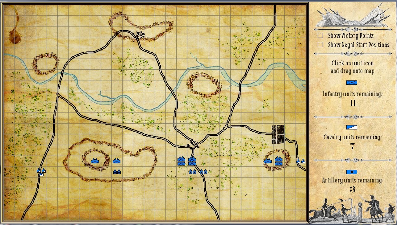
Screenshot of placing your units on the map before battle.

Screenshot of placing your units on the map before battle.
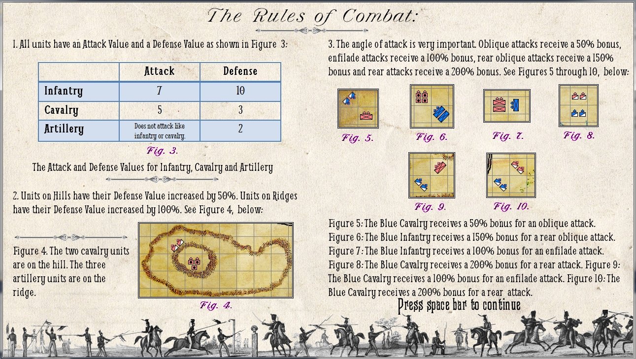
The combat rules for General Staff (screen shot, click to enlarge).
We’re finishing up the Proof of Concept Demo and we wanted to post some screen shots.
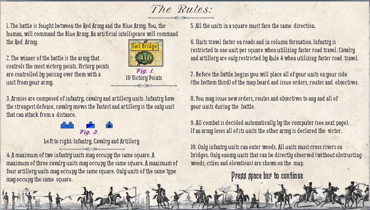
Screenshot of the rules screen from the proof of concept demo of General Staff.
A key element of General Staff gameplay is the notion of ‘fog of war’. In essence we keep three maps: what blue thinks the situation is, what red thinks the situation is and where all units actually are on the map.
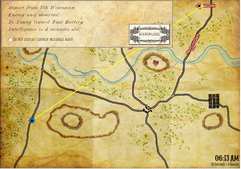
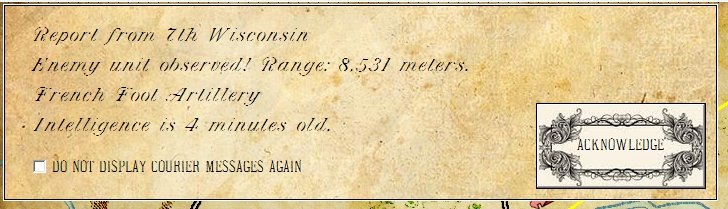
A courier reports that an enemy unit was observed four minutes ago. Note: the enemy unit has almost certainly moved on since then. (Click to enlarge.)
Location of your headquarters (HQ) unit is vitally important in General Staff. If an enemy (or friendly) unit is not directly observable to your HQ unit, the information of an enemy unit sighting is passed to HQ via courier. The amount of time for the courier to travel from the observing unit to the HQ is precisely calculated (see screen capture, above). Friendly units report their position every hour and dispatch a courier to HQ with this information as well. The time for a courier to travel from the reporting unit to travel to HQ is also calculated.
In essence, then, locating your HQ unit on a hill, ridge or other prominent feature is important if you want a clear view of the battlefield. Otherwise, you will be dependent on your couriers to penetrate the fog of war.
The phrase, ‘Fog of War’ (or Nebel des Krieges in German) was first written by Carl von Clauswitz in his famous treatise, On War (in 1832, first English translation in 1873):
War is the realm of uncertainty; three quarters of the factors on which action in war is based are wrapped in a fog of greater or lesser uncertainty. A sensitive and discriminating judgment is called for; a skilled intelligence to scent out the truth.
— Carl von Clausewitz
Update: some readers at Kriegsspiel Forum have quite correctly pointed out that at great distances units would certainly not be able to ascertain the name of the unit that they are observing. Consequently, we have changed the information provided to this:
Dispatch from observing unit modified to include distance and just unit type. (Click to enlarge.)
Now the question arises: how far could you see with a 19th century telescope? Do we need to include a maximum range for line of sight? Interesting question. Would like to hear your comments.
We have been going back and forth on the question of: should General Staff have a 2D or 3D battlefield? Arguments can be made on both sides. The key points for 3D are:
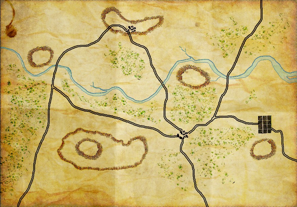
A General Staff topographical map in 2D. (Click to enlarge.)
So, after going back and forth on this issue for many months, we finally did some tests (thanks Ed Isenberg!). And here is what the same topographical map looks like utilizing our stored elevation data:
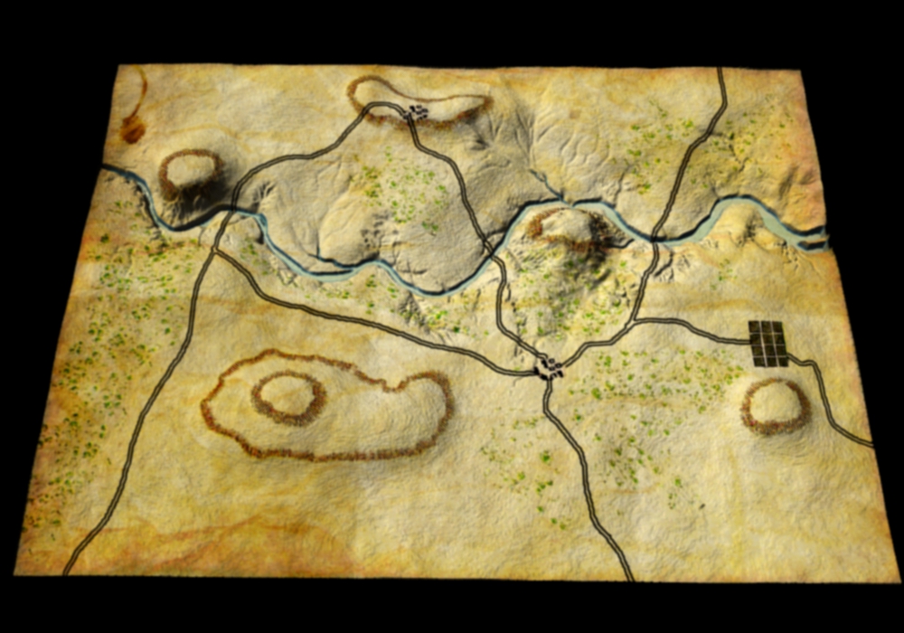
The same topographical map rendered in 3D. (Click to enlarge.)
Well, it’s definitely 3D. But, it appears to me, that we’ve lost more than we have gained. The user hasn’t acquired any new information; hills, rivers, ridges and valleys were all quite apparent in the 2D map. We’ve also lost that wonderful historical Kriegsspiel feel of Victoriana typography and cartography. Our 3D display looks like a wrinkled pigskin and not a map that was used by the General Staffs of the great armies of the world. Also, not being in 3D will facilitate porting General Staff to smartphones.
We certainly would like to hear your opinion. But, as things stand now, General Staff will be moving forward in 2D.