Tag Archives: topographical maps

Map Editor Documentation Now Available Online!

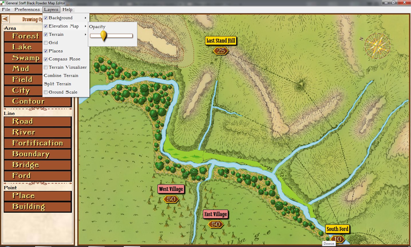
Screen capture of the Map Editor (working on the battle of Little Bighorn). Click to enlarge.

We are extremely pleased to report that the documentation for the General Staff Map Editor has been completed and is now available online at Famdom (link: https://general-staff-wargaming-system.wikia.com/wiki/The_General_Staff_Black_Powder_Map_Editor). There is also a link from the Map Editor itself to the online documentation (under the Help menu). This, of course, means that the Map Editor will be released for beta-testing in the next day or two.

During the course of my professional career I have worked on numerous programs that create or facilitate the drawing of maps for wargaming and military simulations. These include my own UMS, UMS II, the War College and TIGER / MATE (created for DARPA) as well as an extremely large  US Army Military simulation with a budget of over a billion dollars.

Creating easy to use military topographical map programs is not a trivial undertaking. Dr. Ken Forbus, and his group at Northwestern, worked for years on the NuSketch project (link here and here).

I believe that the General Staff Map Editor utility is the best program of its type commercially available and, in fact, is superior in ease of use to the billion dollar equivalent. The Map Editor supports digitizing tablet and pen as well as two-button mouse with scroll wheel. Andy O’Neill (see here) did a remarkable job coding the Map Editor.

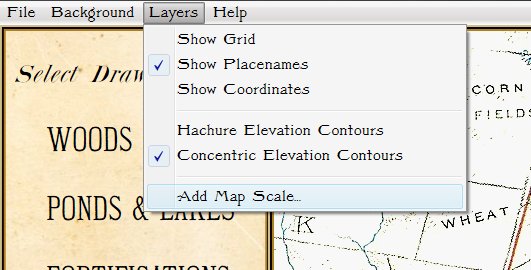
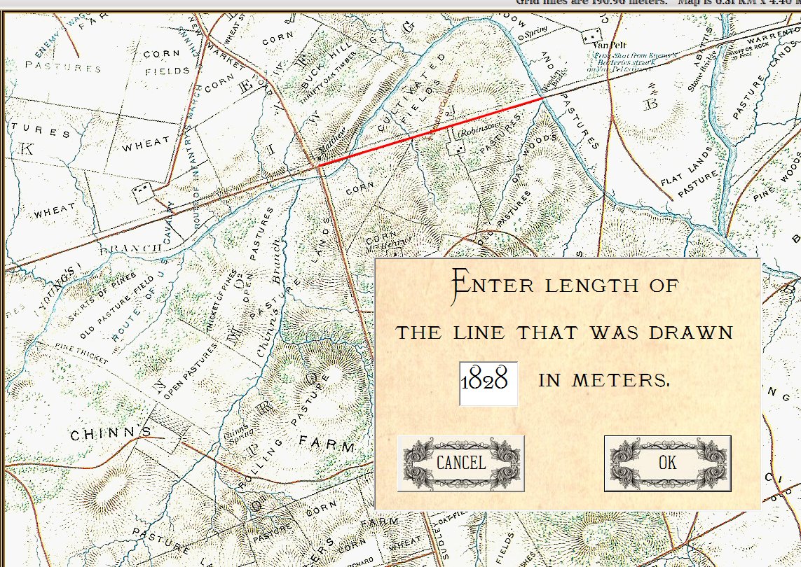
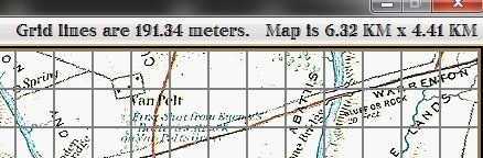
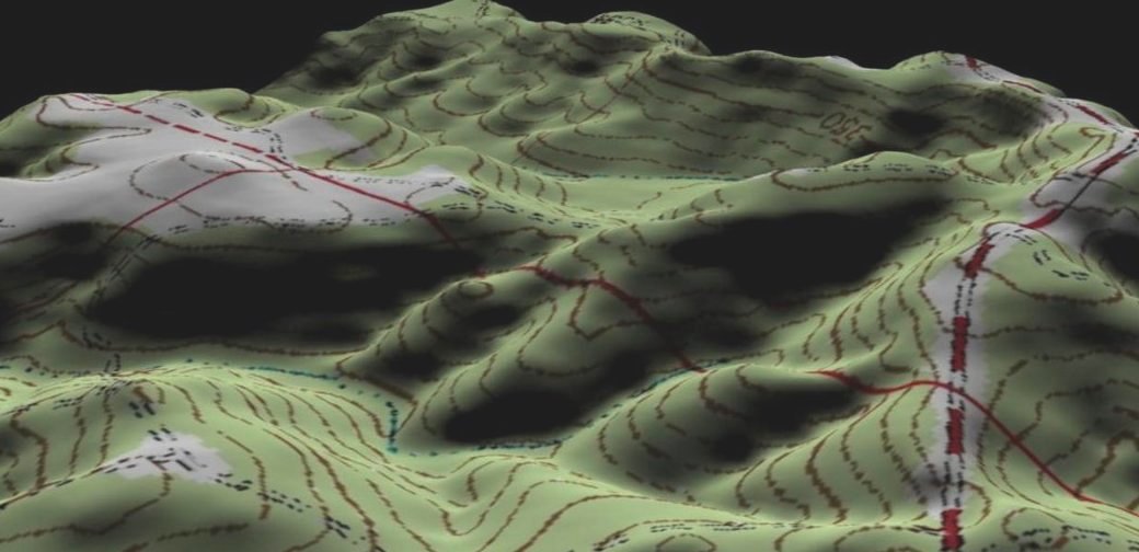
In essence, the Map Editor is a 3D paint program that allows the user to draw terrain, topography and elevation. The maps are then used in the General Staff Wargaming System and can be printed out for your own use.

If you were an early backer of the General Staff Wargaming System (Kickstarter and Indiegogo) you will be receiving an email shortly to go to the ‘secret beta-test site’ and download the installer for the Map Editor.

Any questions or comments? Please feel to contact me directly.


How to Add Scale to Created Maps

One of the many interesting features in the General Staff Wargaming System is the ability to import maps from old atlases or from the internet. While we intend to film a complete instructional video (we’re thinking of including a set of instructional videos explaining how to use the Army Editor, Map Editor and Scenario Editor) we thought we would first share a sneak peek of how to import a map from an old atlas.

An integral part of my office library, a well-worn volume of “The Official Military Atlas of the Civil War”

The “The Official Military Atlas of the Civil War” is one of my favorite books and, like many Grognards, I have dreamed about maneuvering units across these famous maps. I recently realized that I now had all the tools to do exactly that with the General Staff Wargaming System.  First I scanned the map I wanted (the First Bull Run / Manassas battlefield) using an inexpensive flat-bed scanner attached to an ink-jet printer. Then I imported it into the General Staff Map Editor using the built-in feature.

Next, measure the distance between two key geographic points on the map using your trusty Rock Island Arsenal Museum & Gift Shop souvenir plastic ruler.

Measure the distance between key geographic features using a ruler.

Next look up the scale of the map at the bottom:

The scale of this map is 2,000 feet to the inch.

Use Google to do the math (yes, this is actually a programming assignment that is often assigned to first semester college students in CS1).

Three inches = 6,000 feet. Convert to meters.

Just learned that the reprint of the Official Atlas of the Civil War was printed 10% smaller than the original so 3 inches actually equal 5,400 feet!

Next, select the ‘Add Map Scale’ feature in the General Staff Map Editor.

Select the ‘Add Map Scale’ menu item.

Click and drag a line on the map between the same two key geographic features that you previously measured and enter the length in meters:

Enter the length of the line you just drew on the map in meters.

And – voila! – General Staff automatically calculates the map scale:

General Staff calculates and displays the scale of the map you just imported.

2D or not 2D (that is the question).

Let’s just start off by saying that General Staff will be in 3D. It’s the only way to display the blocks that represent units. But the question is: should the map be flat with just 3D unit blocks (simulating the original Kriegsspiel ) or should we employ a technique that I used for a project for the  U. S. Army in which a 2D topographical map was used as the skin for 3D elevation that was extrapolated at runtime from USGS (United States Geological Survey) data?

A screenshot of a project that I did for the Army. Click to enlarge.

A screenshot of a project that I did for the U. S. Army. Click to enlarge.

There are certainly pros and cons for both ideas. Frankly, I like the idea of using a flat, 2D, map with only the unit blocks in 3D. However, the one thing I don’t like about ‘traditional’ Kriegsspiel is that the unit blocks are rigid and always perfect rectangles that do not conform to map contours or allow units to change formations.

On the other hand, I’m concerned that if we go full 3D (like in the above screen capture), it’s going to be to similar to current 3D wargames (I won’t mention names, here).

I’ve tried to keep the overarching theme of ‘simplicity’ for General Staff in clear view. General Staff is supposed to be a fun, simple game where the graphics don’t get in the way of a pure tactical, enjoyable real-time game.

Either way, we will be employing my optimized 3D Line of Sight (LOS) algorithms. That is to say, units behind ridges will not be visible to opponents.

What do you think? Send us a note or leave a reply.